Frequently Asked Questions
What is EOPORT?
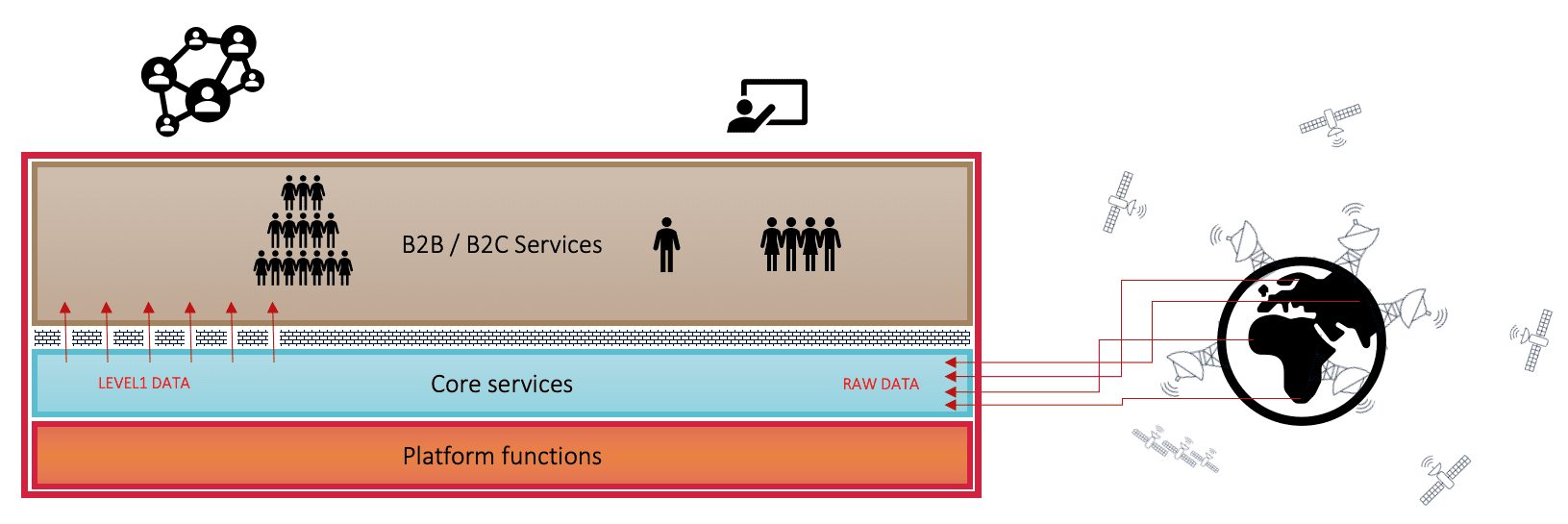
EOPORT is a platform enabling sensor data in Near Real Time for exploitation by service providers, offering a fully automated end-to-end framework with tools for satellite data access, processing, utilization and commercialization.
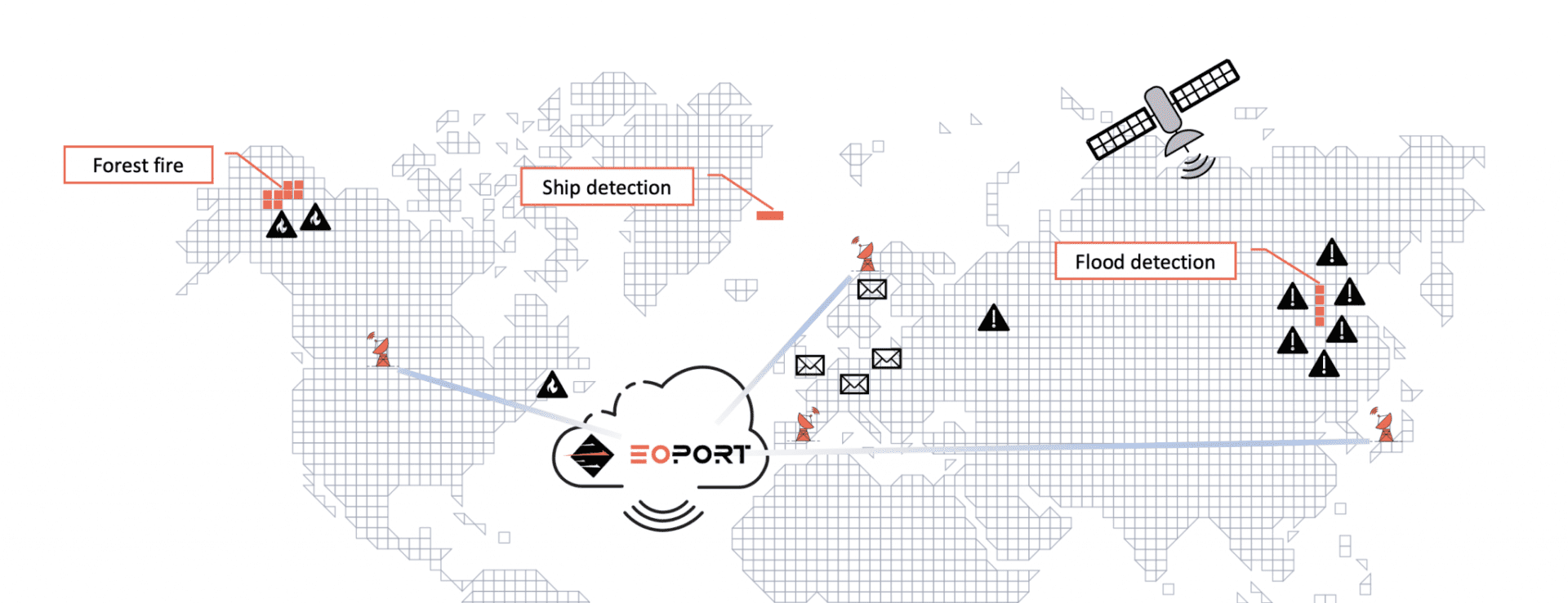
The platform stimulates to business development through collaboration between data providers, service providers and end-users by leveraging on data feeds from a network of ground stations, a cloud production environment and end-user initiated production through service subscriptions.

How can I access data?
As an end-user you access data through subscription on one or more services on the EOPORT platform.
Data you receive is service dependent and varies a lot. The same is the case on frequency, relating to how often a satellite sensor capture data over your Area Of Interest. A large Area Of Interest trigger production more frequent than a small Area Of Interest.
As a service provider you get access to data only by selecting one or more input services. You define a dependency between your service and other B2B services on EOPORT.
Your service will be activated by the EOPORT orchestration engine whenever it is part of a production chain belonging to a subscription.

How much does it cost?
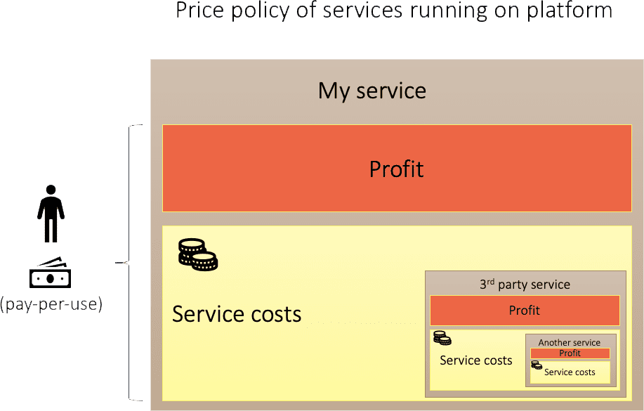
EOPORT offers access to value adding services on a pay-per-use basis through subscriptions.
Each service has a price based on the utilized data (area or volume), cloud resource consumption, service costs, platform fee and its own profit.
A price offering for a service is entirely up to the service provider.
End-users are nominally invoiced on a monthly basis.
Data and service providers get accumulated profit payout on a monthly basis.

How can I become a service provider?
To become a service provider on EOPORT, you first need to register as a user, when this is done you can register your service.
If you target your service to end-users you can read more about B2C here, or if you aim to deliver value-adding in co-operation with other EOPORT service providers then you can read more about B2B here.
If unsure or need assistance, please contact us at EOPORT.

How can I offer my satellite data?
The EOPORT team is expanding the satellite data offering on the platform.
The focus of EOPORT is to offer access to the data as soon as possible, preferable in real time. In order to achieve this, satellite data must be transferred from a ground stations in parallel to satellite to ground downlink, without any production delay.
For maximum efficiency, the EOPORT concept is leveraging on processing of raw data in a scalable public cloud environment. Bringing your processor to EOPORT, installed in your own private tenant, helps service providers enable value-adding at the right time for their NRT oriented customers.
Processing outside EOPORT only on a case-by-case basis dependent on business potential.
Please contact us for help on mission integration.

Can I order satellite images at EOPORT?
EOPORT does not offer the opportunity to order satellite data. Acquisitions from pre-tasked missions such as Sentinel-1, can be subscribed to.
Externally ordered imagery from a satellite mission operator can be routed into EOPORT through a connected ground station for further exploitation by your service.

When will my AOI be covered?
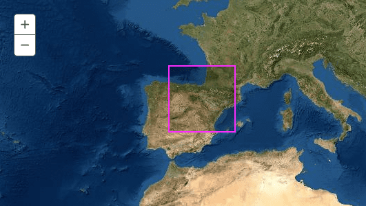
The satellite coverage of a specific Area Of Interest (AOI) depends on the satellite, location and size of the AOI. For polar orbiting satellites, the coverage is typically better at higher latitudes.
The Sentinel satellites implements a pre-defined mission observation scenario fulfilling the observation requirements of the Copernicus services and of the ESA member states.
Detailed information on the planned Sentinel-1 observations in terms of Sentinel-1 acquisitions (SAR mode, date, start-stop times, polarization, etc) are provided with KML files available here.
Satellite acquisition plans may be available from mission operators directly, EOPORT is currently not offering this service.
